
EDIT: I have finally discovered the trick to getting the latest Landsat images on Google Earth Engine … which means my whole blog post below is incorrect. I had a feeling it would turn out like this, because honestly? Whenever you start giving too much credit to Europeans, that should be the red flag to let you know, “something ain’t right.”
But I will leave this blog post up, so if anyone else is having the same issues, they can find it and then find the solution here.
Note: if you want to know more about why satellites like Landsat are important, see this animation or this animation.
I used Google Earth Engine to complete a large part of my Ph.D. dissertation. I needed lots of images taken by satellites. Like, I needed thousands.
There’s a couple ways to get these images (for free!) You can go to a NASA website, and make an order. You have to do a lot of clicking to get it done, and then you have to wait a few days for the order to show up in your email. Then you have to download all the images. They take up a lot of room on your laptop. You have to figure out how to organize them, and then you have to load them into whatever computer program you’re going to use to analyze those images.
Or you can use Google Earth Engine. As much as I hate to give more power and control over to Google, this feature is very helpful. They already have all the millions of satellite images out there uploaded onto the Google servers. Instead of waiting a few days for a NASA order to come through, you can access those images with just a few lines of code in Google Earth Engine. You don’t ever have to download the images to your own computer or laptop, because you can analyze them right there in Earth Engine. The whole process is streamlined, you save so much time, and you don’t clog your harddrive up with huge satellite files.
Well, that’s all in the past now. NASA has apparently given up cooperating with Google Earth Engine. I tried to search if there was an announcement made to that effect, but I didn’t find anything. But it is a fact that if you search for Landsat images on Earth Engine, you will easily dredge up old images, going back to the 1970s. But there are no new images, not for Landsat-7 and not for Landsat-8. In fact, there are no Landsat images past April 30, 2017. Hmmm. I wonder what changes engulfed NASA’s ultimate leadership right around then, so that the ripple effects eventually led to this change in April 2017?
At least, they did not delete all the images that had already been uploaded. So images from the 1970s to April 2017 are still available.
If I’m wrong about this, and the new images are up there somewhere, someone please let me know. I have searched a couple spots on the globe and it is the same every time – nothing new after April 2017.
Yesterday, I searched for Houston in March 2019. I wanted images from the sky of that terrible oil fire that occurred. But I found no Landsat images. However, I realized there was potentially a work-around. The Europeans have launched their own satellites, and thank goodness, because ever since 2016, they have been loading their images from Sentinel-2 onto Google Earth Engine. And they are still loading away — looks like Trump can’t stop them. There were in fact 18 images from the Sentinel-2 satellite for Houston sprinkled between March 1 and April 15, 2019.
Alas for me though — no image showed the black smoke of the fire. That was what I wanted. The fire started on March 17. The first satellite image after the fire (March 18; below) had a thin coverlet of clouds covering Houston, and you can’t see anything through it.
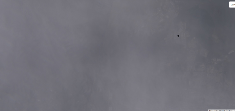
The next satellite image came on March 20, but alas again — there’s no more fire to be seen. Do you see black smoke?
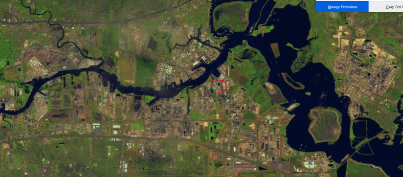
That black dot in these images is supposed to be the location of the company that started the fire, or there-abouts. Zooming in a little closer …

Well, maybe that is black smoke, but I don’t know that it’s going to convince any one.
Sentinel-2 has a band for “coastal aerosol”. Maybe that will be the key to being able to tell where the plume of black smoke is.
My Earth Engine code for getting these images is here.
